
 MTB tour St.Gallen - Wissegg - Stoos - Ruppen - Trogen - St.Gallen (16 April 2007)
 |
51 km |
| 1449 m ^ | |
 |
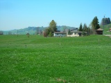
Unterer Brand 16-04-2007 10:46 9.3817°E, 47.4083°N, 825m |
 |
Egg, view to the north 16-04-2007 10:59 9.3867°E, 47.3981°N, 965m |
 |
Egg, view over Teufen, with the Alpstein massif in the background 16-04-2007 11:01 9.3867°E, 47.3981°N, 965m |
 |
Hüslersegg 16-04-2007 11:09 9.3983°E, 47.4003°N, 1005m |
 |
Waldegg, view towards the east 16-04-2007 11:13 9.4097°E, 47.4025°N, 995m |
 |
Waldegg, view towards the Alpstein 16-04-2007 11:15 9.4111°E, 47.4028°N, 986m |
 |
Wissegg and the Alpstein massif, the Säntis on the right 16-04-2007 11:47 9.4311°E, 47.3825°N, 1023m |
 |
Stritegg and, behind, Buechen 16-04-2007 12:01 9.4372°E, 47.3864°N, 1075m |
 |
Wissegg, left the descent towards Trogen 16-04-2007 12:12 9.4592°E, 47.3925°N, 1060m |
 |
Ruesitz, view towards Gäbris 16-04-2007 12:37 9.4889°E, 47.3856°N, 1150m |
 |
Stoss 16-04-2007 12:52 9.4917°E, 47.3600°N, 960m |
 |
Hoggen, the street to St. Anton climbing to the back 16-04-2007 13:59 9.5244°E, 47.4056°N, 1060m |