


Stams
 |
CH (GR), 9.6024°E, 46.9138°N | |||
 |
1645 m | |||
 |
Trimmis, 637m, 9km | |||
 |
Valzeina, 1126m, 10km | |||
 |
||||
 |


")
| |||
 |
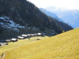
on both sides good ways up to the chalets of this pass | |||
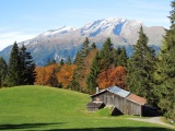
The Calanda mountain as seen from Falir (between Says and Stams) | ||||
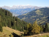
View from Stams over the valley of Valzeina and towards the Rätikon chain, with the Schesaplana summit | ||||
Stams | ||||