


Katschbergerhöhe
 |
AT (KÄ-SA), 13.6156°E, 47.0592°N | |||
 |
1641 m |  |
AT-2-1641 | |
 |
St. Michael, 1046m, 6km | |||
 |
Kremsbrücke, 952m, 12km Mühlbach, 1221m, 4km | |||
 |
||||
 |


")
| |||
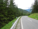
Katchberg road on its north slope | ||||
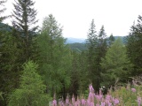
Katschberg, view to the south | ||||
|
AT (KÄ-SA), 13.6156°E, 47.0592°N | |||
|
1641 m | |
AT-2-1641 | |
|
St. Michael, 1046m, 6km | |||
|
Kremsbrücke, 952m, 12km Mühlbach, 1221m, 4km | |||
|
||||
|
| |||
|
Katchberg road on its north slope | ||||
|
Katschberg, view to the south | ||||