


Hohberg
 |
CH (FR), 7.3348°E, 46.6757°N | |||
 |
1469 m |  |
CH-FR-1469 | |
 |
Sangernboden, 977m, 7km | |||
 |
Sangernboden, 977m, 6km | |||
 |
||||
 |


")
| |||
 |
no way on the north slope | |||
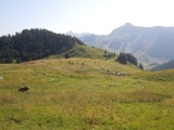
Hohberg, with the Ochsen and Märe summits on the horizon | ||||
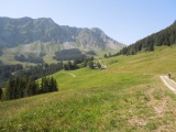
From Hohberg towards Geissalp and Kaiseregg | ||||